
GIS. LIVE. VIZ.
We are team of talented hackers making websites mappy, smart, and alive!
Services
Featured Srvices
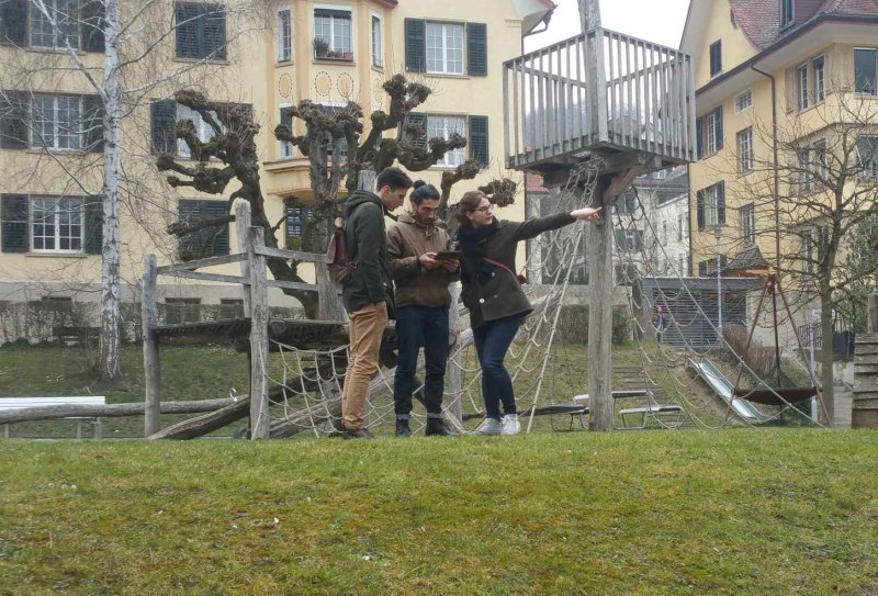
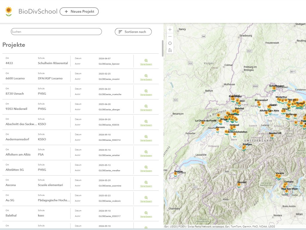
Digital Applications in Education
Design, development, and operation of web-based applications for schools, universities, and vocational training institutions—tailored to support interactive learning environments and administrative workflows.
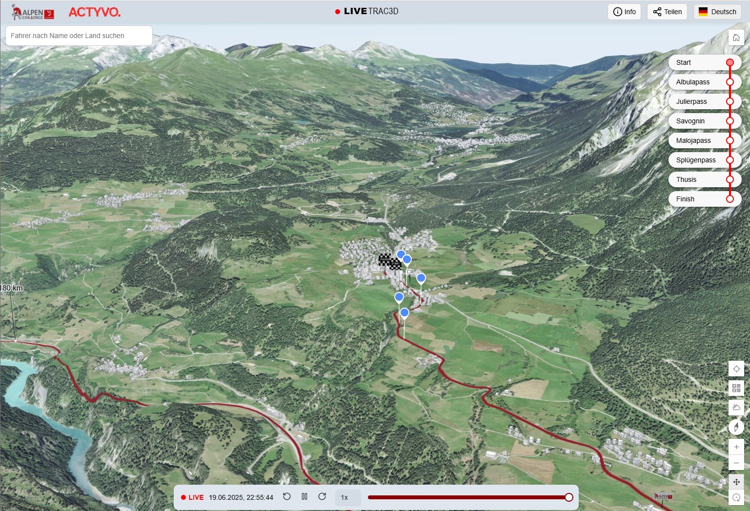
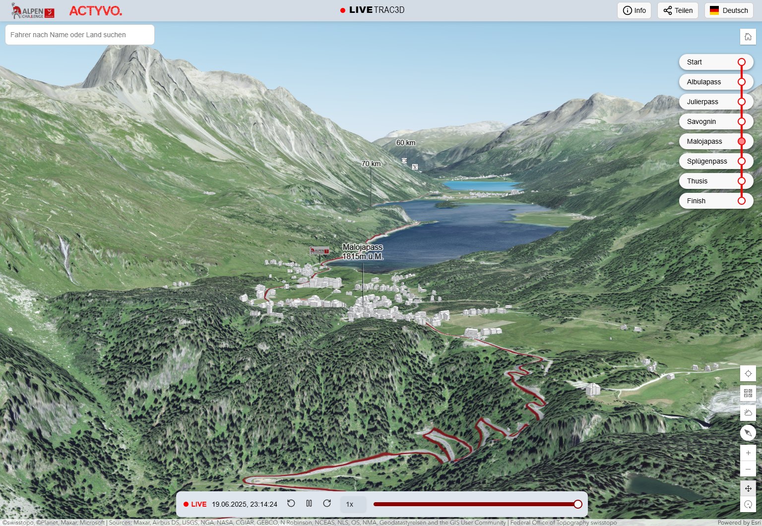
GIS for Sports & Events
Development of interactive map-based applications for the sports and event sectors – including real-time tracking of athletes during races or tours, spatial analysis for event logistics, and engaging visual data insights for organizers and audiences.
Consulting & Communication
Strategic and technical consulting for digital projects – with a focus on communication architecture, user-centric design, and effective integration of GIS into broader information systems.


Services
CHECK OUR SERVICES
Live Data Integration
Real-time visualization of sensor data, sports tracking, weather updates, or traffic flows – seamlessly integrated into the map frontend via WebSockets, MQTT, or REST APIs.
Interactive Chart Visualizations
Integration of dynamic chart types (e.g. time series, heatmaps, bar and line charts) to analyze and represent spatial-temporal patterns within GIS applications.
2D/3D Map Visualizations
Development of immersive map interfaces with layer control, animated transitions, and 3D terrain rendering – ideal for environmental monitoring, route planning, and topographic analysis.
Sports Tracking & Replay
Visualization of sporting events on maps – with live athlete positions, time sliders, GPS replay functionality, and elevation profiles for spectators or post-event analysis.
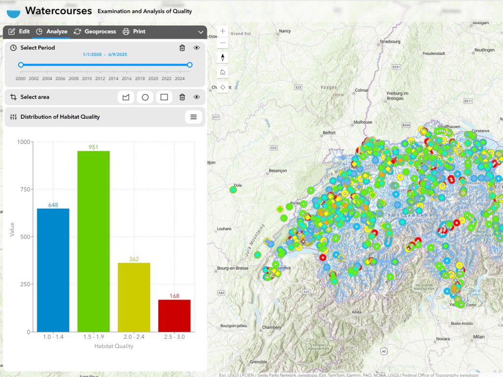
Dashboards for Data Collection Campaigns
Map-based dashboards to visualize environmental data such as air quality, temperature trends, or biodiversity metrics – enhanced with charts and 3D mapping layers for contextual analysis.
Market Analysis & Talent Development
Development of interactive WebGIS tools to analyze educational offerings, career opportunities, and regional workforce needs in the geospatial sector – combined with platforms to promote training initiatives and career pathways.
Portfolio
CHECK OUR PORTFOLIO
- All
- GIS
- Environment
- Sport

Team
CHECK OUR TEAM

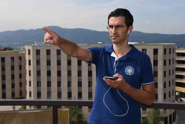
Christian
Founder & CEO
Daniel
Software Engineer(Freelancer)
Marianna
Design & User Experience (Freelancer)Contact
Share your opinions and requests